Navigational aspects in VFR flying today

In this article I want to review the basic principles of Visual Flight Rules (VFR) navigation and point out in which situations those rules are hard to rely on. Well the foremost principle of VFR flying is that the pilot can rely on visual reference every time during flight. That does also imply the pilot can determine the aircraft's attitude in relation to the horizon by just looking out the cockpit window.
Due to that definition of VFR the basics in navigation are also related to those principles i.e. the pilot should look outside the window to determine its lateral position. For the vertical position in space a VFR pilot relies on the altimeter mounted on the instrument panel. In that sense and in theory the only instruments a VFR pilot should really need for navigation in order to conduct a save flight are a speed indicator, a compass, a clock and the mentioned altimeter.
I have experienced that within familiar terrain and in good meteorological conditions this basic dead reckoning works well and one makes it save to a planned destination by applying these rules. However, when flying to countries where you’ve never been before, knowing the landscape only from studying the ICAO (1:500 000) chart prior to flight this type of navigation hosts some real weaknesses for a save and efficient flight. Not to mention the hazards when additionally flying in lower weather conditions near the designated VFR minima or within controlled airspace comprising Air Traffic Control (ATC).
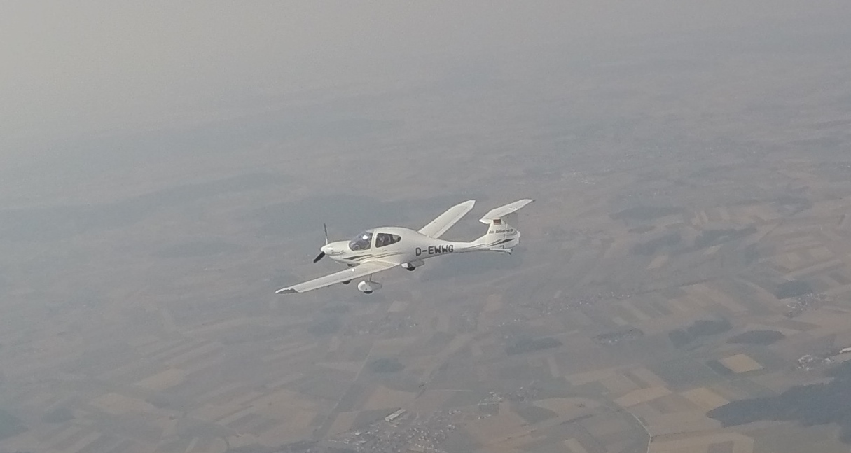
However, I want to emphasize that every pilot should be capable of applying the basic navigational procedures described above as those are the most fundamental aspects upon which you improve your further flying skills. I am still using those methods i.e. flying a compass heading in combination with timing on, for example, local scenery flights. By looking out the window when flying over familiar terrain you are always able to determine your actual position and correct it if necessary.
Another very important aspect which was already indicated above and makes it very hard to stick to those basic definitions of visual flight rules is the issue of controlled airspace and air traffic control. There are various types of airspace categories which involve certain rules for aircraft operating within such as clearance, aircraft equipment (mostly ATC related stuff), separation (from other aircraft and clouds) and visibility. The airspace structure guarantees that air traffic takes place in a save and ordered manner. ATC and you as a pilot are committed to stick to that rules whenever operating in those airspaces. The issue on precise navigation and highly accurate VFR flying becomes especially important in airspace categories D, including CTR’s , C and B. First those airspace categories require ATC clearance prior entering. When operating in those airspaces you are continuously in contact with ATC and they will instruct you to change heading and altitude whenever traffic or other reasons require. In addition ATC most often does not instruct you with a certain heading but tells you to fly inbound to a certain VFR waypoint. A VFR waypoint is simply and in the vast majority of cases a geographical spot somewhere in the landscape.
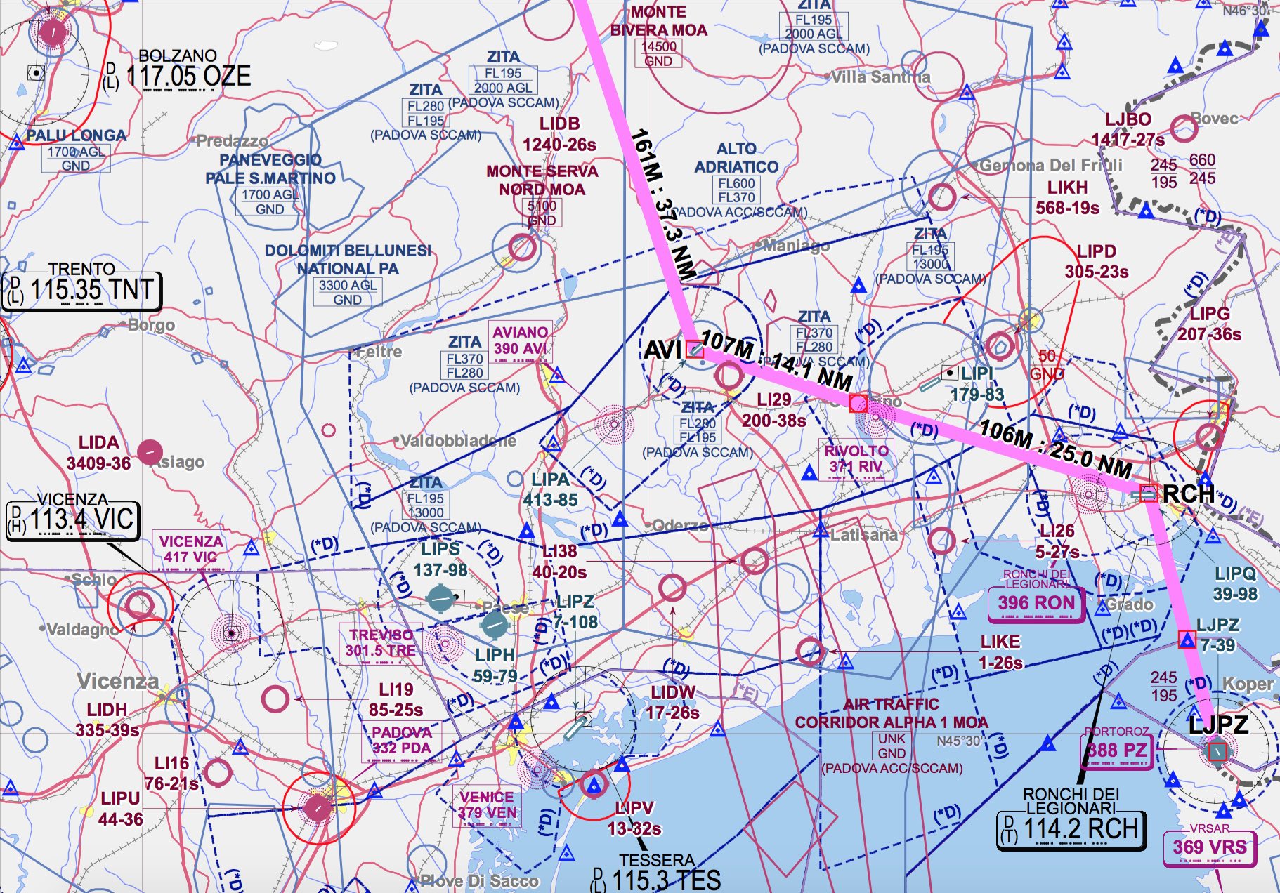
Although you have every VFR waypoint labeled on your VFR chart to get to this point you need to know your current position. If you are flying a leg between two of your planned waypoints due to wind or an instructed climb in which you fly slower than leveled (and so planned), unless there is a VOR or other navigational aid, you might determine a new heading towards a new waypoint only within an accuracy of plus/minus 2-3 degree. In addition you also have to calculate the distance and the corresponding time upon reaching this waypoint. If you now imagine that this waypoint is located somewhere in an area of unfamiliar lowlands (e.g. Po Plain in Italy) you are going to have hard times in fixing your position upon reaching the point. If you should then go towards another ATC instructed waypoint or just resume to own navigation the accuracy in determining the new heading is even worse and things can become complicated quickly.
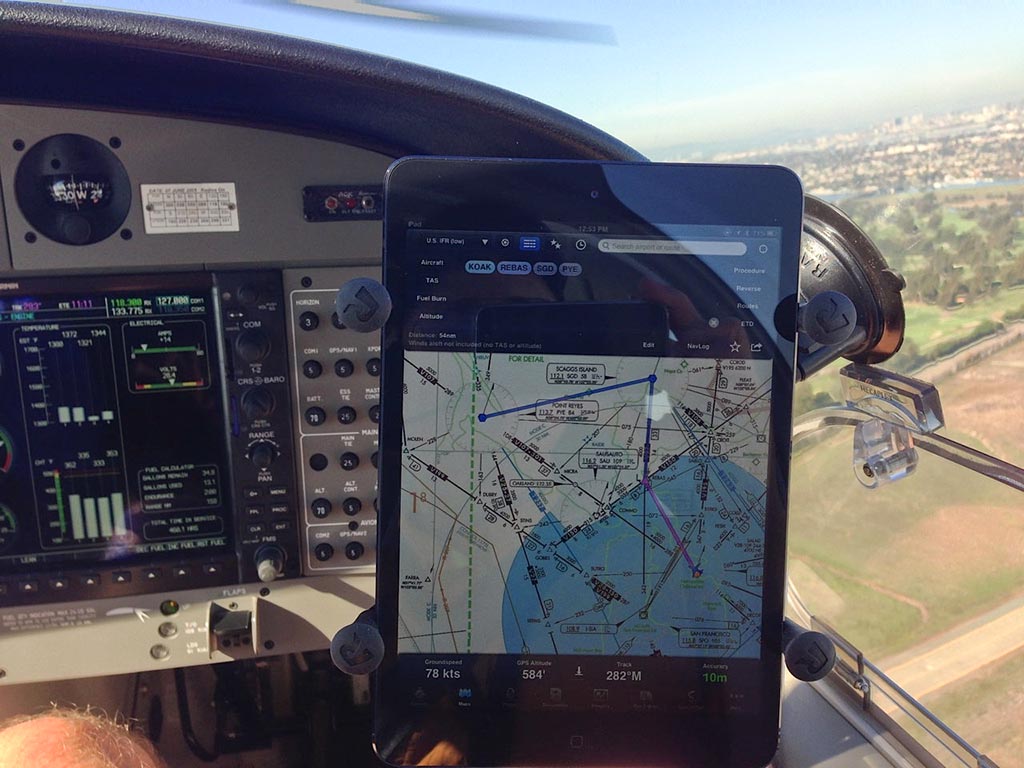
If you read carefully you might realize that in principle what ATC is demanding from us VFR pilots is to be capable of precise random or area navigation - in IFR jargon its called RNAV and its based radio navigation aids and Global Navigation Satellite Systems (GNSS) such as GPS. In that sense I want to point out that in order to fulfill the high expectations of navigational accuracy in such airspaces one is basically forced to use GPS with up-to-date VFR charts. Nonetheless as GPS can fail a VFR pilot should also train navigating by traditional aids such as VOR or dead reckoning whenever possible. Also the often underrated ability to fly a constant heading at a constant altitude while talking to ATC or studying the approach plate should be trained whenever possible.
Nonetheless, after these explanations, remember that the most fundamental principle i.e. being capable of relying to visual reference at all times during flight may never and under no circumstances be violated! Hope you also see the point that some basic GPS navigation is nearly indispensable in today’s cross country VFR flying.