
Tropical Cyclone Pam

On 14. March 2015 a tropical cyclone called "Pam" hit the capital of Vanuatu, an island located east of Australia in the pacific ocean ...
 The tropical cyclone Pam is one of the strongest storms seen in the South Pacific in years and the strongest storm to make landfall since the devastating Super Typhoon Haiyan hit the Philippines in 2013. I received the following high resolution images of Pam via my EumetCast reception station on 14.03.
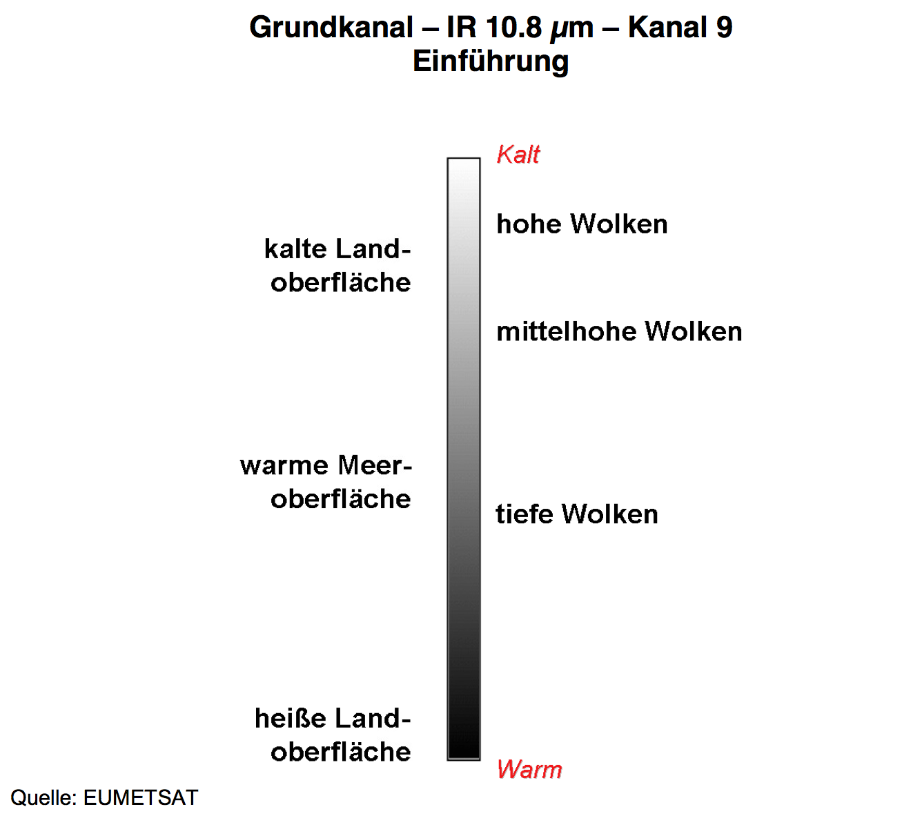
Both images are recorded from MTSAT-2 positioned at 145° East. One image shows Pam in the visual range, the other image in the infrared IR range at 10.8 µm. To understand the information coming from that IR image the diagram on the right shows how one have to interpret the 10.8 µm (additional explanation down at the second image description).
This the first image is recorded in the visual range of the spectrum (e.g. as you would see it with your naked eyes). I marked the tropical cyclone with a red arrow. There are hardly any clouds over Australia at that time and so the continent is clearly visible on the image.
This the second image is also recorded by MTSAT-2 but now in the infrared (IR) part of the spectrum particularly at 10.8 µm. Australia is now shown dark (e.g. a low amplitude signal is coming from that warm/hot surface). At this wavelength you now see the cold (and therefore high altitude) clouds of the cyclone (red arrow). Also notice that the familiar day/night distinction is not visible anymore.


https://blog.hochstaffl.eu/index.php/eumetcast/impressive-satellite-images/27-tropical-cyclone-pam#sigFreeIdce96e300fa